MISC. UPPER POTOMAC COALFIELD
Memorial to coal miners at Elk Garden, WV in Mineral County. Elk Garden was such an important coal mining center that this coal field was known by the
name "Elk Garden Coal District" before being renamed Upper Potomac Coalfield. The Elk Garden coal camp and coal mines were located on the mountain top above the North Branch of the
Potomac River. Some, but not all, of the town was composed of coal company housing. Others built their own homes on land rented from the coal company. The railroad reached Elk Garden in the 1880's,
and the Pittsburgh (or "Big Vein") seam reserves around Elk Garden began to be mined. That coal seam only occurred in small hilltop areas in the Elk Garden vicinity, but it was so thick (up to 16' thick) and
pure that it was economical to mine. It was thought that there were originally 315 acres of Pittsburgh coal at Elk Garden. By 1923 only 2 acres remained. Sewickley seam coal was also mined.
After 1920's the Elk Garden mines went into decline, although there has been occassional strip mining right into the 21st Century.
Coal camp at Oakmont, W.Va. Coal companies at or near Oakmont inclued Abrams Creek Coal & Coke, Ajax Coal Co., Eddy Coal Co., and Oakmont Smokeless Fuel Co.
Coal company houses in Bayard, W.Va., probably constructed by the Emmons
Coal Mining Co.
Henry, WV was one of two coal company towns in Grant County, WV (Parts of Bayard were the other). Davis Coal & Coke Co. built a small town here to house the employees of their
No. 22 coal mine. The mine produced off and on from 1903 until 1928. Nothing remains of Henry, WV today.
Brass tag from the Henry mine.
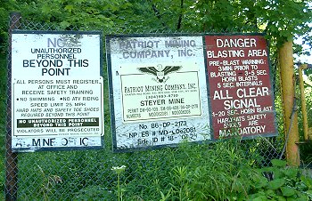
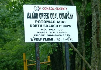
Sign at a coal mine in Maryland along the North Branch of the Potomac.
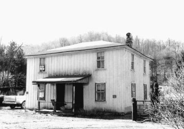
This structure used to be the superintendent's house at Steyer, MD. At first a lumber camp, Steyer was reconfigured
into a coal camp in 1903 by the Datesman Coal Company, who actually constructed this home.
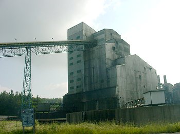
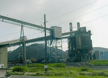
A 21st Century coal preparation plant in the Potomic Coal Field is the Mettiki Plant, near Kempton, MD.
Coal being loaded in trucks at the Metiki coal processing facility. They were probably taking it to the power plant across the
river in West Virginia.
This was the last remaining house in the Dodson, MD coal camp when this photo was taken in 1981. Dodson was opened by
the Garrett County Coal Mining Co. in 1903. They eventually opened at least seven mines at Dodson. Right after
they opened their first mine, the Maryland mine inspector's report read, "The company has gone to considerable
expense and laid out a nice village and built several houses close to the mine ... the tipple or dump is
connected with the W.Va. C. & P. R.R. by a siding; a substantial bridge crosses the Potomac River."
Gormania, W.Va. - a place that time has passed by.
Coal tipple from the Potomac Valley region from the 1960's or 70's.
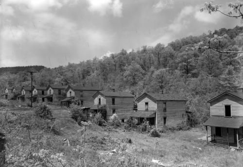
This is what the coal camp at Vindex, MD looked like after the mine closed and most residents had to leave. Johnstown Coal & Coke Co. opened the Vindex
coal mine in 1906. As late as 1949 the mine employed 155 men, but it closed in 1950. The president of Johnstown Coal & Coke, Andrew Crichton, announced that the mine's closure was temporary, and due to lost
markets for the product. Johnstown said that there were plenty of reserves for when the mine opened back up, but it never did. Vindex residents began to leave the town, and in 1961 famous photographer Aubrey Bodine took a series of photos of what was left of the coal town.
He found mostly abandoned buildings, but there were a few residents still hanging on. In 1967 Douglas Coal Co. wanted to strip mine the land around Vindex, and Johnstown Coal & Coke asked the remaining 32 families
to leave. James Polino of Douglas Coal was quoted in the newspaper as saying, "Stripping coal takes a lot of blasting. You can't strip coal and do a lot of blasting with people in the way." Such was the way that the 32
families were viewed by industrialists - not as people living in their homes, but as obstacles to profit to be shoved out of the way.
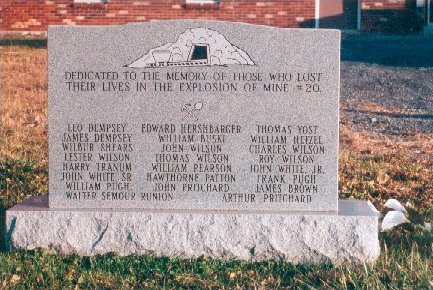
Image by Dee Dovey

Western Maryland Regional Libary [whilbr.org] image

2013 image courtesy of Sherman Cahal, abandonedonline.net

Maryland Geological Survey image
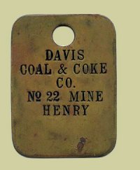
Image by others
July 2003 image by author

Aug. 1981 image by Valerie Cesna, courtesy of the Maryland State Archives
July 2003 image by author
July 2003 image by author
March 1981 image by Valerie Cesna, courtesy of the Maryland State Archives

July 2003 image by author
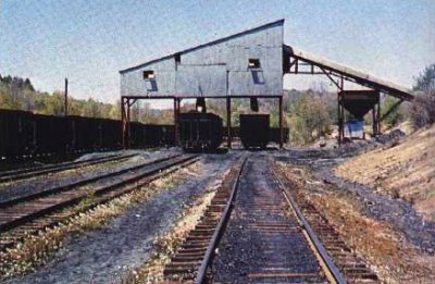
Image by others via Dave Cathell
1961 image by Aubrey Bodine
2003 image by author